Log in
All resources
Create a design
675 Free Artworks of Ships On Maps
bibliothèque nationale de france
maps by willem and johannes blaeu
a map of the british empire in america with the french and spanish settlements adjacent thereto
john rocque 1746 crops from library of congress
john rocque
maps in the library of congress
maps by jodocus hondius
maps by nicolaes visscher i
nicolaes visscher
description de l'universe
considérations géographiques et physiques sur les nouvelles découvertes au nord de la grande mer
1750s maps of the russian empire
commonwealth (ship, 1854)
steamboat advertising
17th-century maps of dorset
maps by john speed
maps by hendrik hondius the younger
1631 maps
maps by nicolaes visscher i
old maps of canaan
maps of hamburg by braun & hogenberg
maps of lübeck by braun & hogenberg
old maps of the republic of genoa
maps by willem and johannes blaeu
naturalism,symbolism
drawings of ships
description de l'universe
alain manesson mallet
description de l'universe
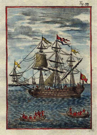
1680s ships
description de l'universe
1680s ships
description de l'universe
1710s ships
a & c black general atlas of the world
1850s maps of the world
hendrik van langren map of south asia
1595 maps of asia
john rocque 1746 crops from library of congress
john rocque's maps of london
carte de la mer méditerranée en trois feuilles (dheulland et al.)
18th-century maps of the western mediterranean
carte de la mer méditerranée en trois feuilles (dheulland et al.)
18th-century maps of the eastern mediterranean
maps by pieter van der keere
old maps of friesland
maps by jakob van der schley
history of hormuz island
carte de la mer méditerranée en trois feuilles (dheulland et al.)
old maps of the central mediterranean
maps of blois by braun & hogenberg
urbanisation in loir-et-cher
maps by daniel stoopendaal
biblical maps
maps by willem and johannes blaeu
1630s maps of asia
redeeming the republic (1890)
1890s maps showing history
civitas vetus (galleria delle carte geografiche)
tower of babel in engravings
maps by nicolaes visscher i
maps of saint paul's journeys
maps by pieter van der keere
old maps of plymouth and devonport
16th-century maps of england
18th-century maps of the british isles
armada tapestries
bibliothèque nationale de france
maps of goa by linschoten
1730s maps of the philippines
baroque painting
18th-century maps of the british isles
armada tapestries
maps by willem and johannes blaeu
1635 maps
sanson map of the german empire (17th century)
sanson maps of the circles of germany
sanson map of the german empire (17th century)
sanson maps of the circles of germany
sanson map of the german empire (17th century)
sanson maps of the circles of germany
american paintings in the chazen museum of art
thomas satterwhite noble
maps by willem and johannes blaeu
1663 maps of africa
sanson map of the german empire (17th century)
sanson maps of the circles of germany
maps of alexandria by braun & hogenberg
bibliothèque nationale de france
maps of santander by braun & hogenberg
bibliothèque nationale de france
a map of the british empire in america with the french and spanish settlements adjacent thereto
1730s maps of the caribbean
maps of deventer by braun & hogenberg
bibliothèque nationale de france
lucas janszoon waghenaer
maps facing east
a map of the british empire in america with the french and spanish settlements adjacent thereto
1730s maps of the caribbean
lucas janszoon waghenaer
1580s maps of spain
a map of the british empire in america with the french and spanish settlements adjacent thereto
1730s maps of central america
1610s maps of the iberian peninsula
maps by jodocus hondius
maps of ancient italy by philipp clüver
old maps of the history of liguria
maps by jodocus hondius
maps by john speed
maps by jodocus hondius
maps by john speed
maps of ceuta by braun & hogenberg
ceuta
maps of lisbon by braun & hogenberg (1572)
maps of cascais by braun & hogenberg
maps of avignon by braun & hogenberg
bibliothèque nationale de france
maps of ancona by braun & hogenberg
bibliothèque nationale de france
maps of provence by pierre-jean de bompar
maps by hendrik hondius the younger
old maps of manhattan, new york city
croton aqueduct
maps of antwerp by braun & hogenberg
bibliothèque nationale de france
maps of ancona by braun & hogenberg
bibliothèque nationale de france
maps of dordrecht by braun & hogenberg
bibliothèque nationale de france
maps of enkhuizen by braun & hogenberg
bibliothèque nationale de france
maps of algiers by braun & hogenberg
bibliothèque nationale de france
pirate
maps
maps by willem and johannes blaeu
1630s maps of the americas
old maps of algiers
maps by juan lopez
magni ducatus lithuaniae
maps facing west
considérations géographiques et physiques sur les nouvelles découvertes au nord de la grande mer
hokkaido in art
john rocque 1746 crops from library of congress
maps in the library of congress
john rocque 1746 crops from library of congress
maps in the library of congress
john rocque 1746 crops from library of congress
maps in the library of congress
birds-eye view of seattle, 1884
seattle
maps of emden by braun & hogenberg
bibliothèque nationale de france
maps of venice by braun & hogenberg
giacomo franco
john rocque 1746 crops from library of congress
maps in the library of congress
considérations géographiques et physiques sur les nouvelles découvertes au nord de la grande mer
isla de los estados
john rocque 1746 crops from library of congress
maps in the library of congress
ships named sebenico
melton prior
17th-century maps of carmarthenshire
17th-century maps of pembrokeshire
claes jansz. visscher (ii)
maps of amsterdam
17th-century maps of the strait of magellan
maps by willem and johannes blaeu
old maps of whole wales (alone)
1670s maps of wales
maps of amsterdam by braun & hogenberg
bibliothèque nationale de france
maps of brielle by braun & hogenberg
brielle in the 16th century
prints in the royal collection of the united kingdom
thomas vivares
maps by nicolaes visscher i
maps by daniel stoopendaal
1780s maps of the americas
1786 maps
collectie archief van architectenbureau baanders
photographs in the stadsarchief amsterdam
historie van indien
de bry family
old maps of katwijk, south holland
brittenburg
a map of the british empire in america with the french and spanish settlements adjacent thereto
bibliothèque nationale de france
a map of the british empire in america with the french and spanish settlements adjacent thereto
bibliothèque nationale de france
a map of the british empire in america with the french and spanish settlements adjacent thereto
bibliothèque nationale de france
a map of the british empire in america with the french and spanish settlements adjacent thereto
bibliothèque nationale de france
descriptio daciarum (17th-century map)
maps by pieter van der keere
maps by willem and johannes blaeu
1617 maps of africa
a map of the british empire in america with the french and spanish settlements adjacent thereto
bibliothèque nationale de france
a map of the british empire in america with the french and spanish settlements adjacent thereto
bibliothèque nationale de france
maps of haarlem by braun & hogenberg
bibliothèque nationale de france
a map of the british empire in america with the french and spanish settlements adjacent thereto
bibliothèque nationale de france
engravings from dick sand, a captain at fifteen by charles barbant
illustrations from dick sand, a captain at fifteen by henri meyer
301 - 400 of 675
Next page
/ 7


![Aethiopia inferior, vel exterior, partes magis septentrionales, quae hic desiderantur, vide in tabula Aethiopiae superioris / [Joan Blaeu], 1663](https://cdn.creazilla.com/illustrations/10000599277/aethiopia-inferior-vel-exterior-partes-magis-septentrionales-quae-hic-desiderantur-vide-in-tabula-aethiopiae-superioris-joan-blaeu-1663-md.jpg)


![Tingis, Lusitanis, Tangiara; Tzaffin; Septa; Arzilla; Sala / [Georg Braun]; [Franz Hogenberg], 1572](https://cdn.creazilla.com/illustrations/10001127353/tingis-lusitanis-tangiara-tzaffin-septa-arzilla-sala-georg-braun-franz-hogenberg-1572-md.jpg)


![Wallia principatus vulgo Wales: Seren[issi]mo Domino Carolo Magnae Britanniae, etc. Principi [signé] Joh. Blaeu, 1673](https://cdn.creazilla.com/illustrations/10001204343/wallia-principatus-vulgo-wales-serenissimo-domino-carolo-magnae-britanniae-etc-principi-sign-joh-blaeu-1673-md.jpg)


